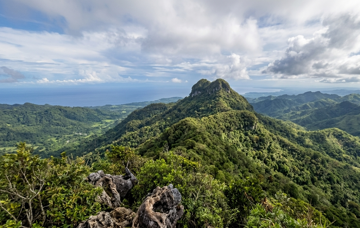
When travelers picture the island province of Bohol, their minds almost instantly drift toward the uniform formations of the Chocolate Hills or the white-sand coastlines of Panglao. However, a growing faction of high-altitude backpackers looking to trade commercial beachfronts for intense physical exertion are heading deep into the interior highlands this May 2026. Mount Matunog, also recognized by local mountaineers as Mount Mayana, stands as an imposing natural monument in the remote, mist-cloaked village of Barangay Mayana within the municipality of Jagna. Rising to a majestic elevation of approximately 864 meters above sea level, this colossal landmass reigns supreme as the absolute highest peak in the entire province of Bohol. Affectionately dubbed the "Little Baguio of Bohol" due to its remarkably crisp alpine temperatures and perpetual banks of low-hanging fog, this rugged crown offers intrepid adventurers an authentic, crisp mountain wilderness experience entirely divorced from traditional island tourism.
Navigating Limestone Scrambles and Ancient Roots
Lacing up for this interior expedition means preparing for a highly demanding, technical out-and-back mountain corridor that tests both physical stamina and lower-body stability. The total trek spans between 7.2 and 7.6 kilometers in length, requiring roughly four to five hours of continuous movement while tackling a grueling vertical elevation gain of approximately 680 meters. The initial segments of the path lead hikers past beautifully terraced municipal rice paddies and the towering, sprawling roots of an ancient centennial Narra tree before transitioning sharply into an unforgivingly steep incline. This technical ascent cuts directly through dense, primeval mossy rainforest environments where trekkers are surrounded by fascinating carnivorous pitcher plants, rare tropical orchids, and patches of sweet, untamed wild strawberries. Lucky adventurers frequently encounter native fauna along the quieter sections of the ridge, including vocal forest birds and troops of wild monkeys leaping through the dense high-altitude canopy.
Midnight Fireflies and mandatory Mountain Guardians
Pushing past the final vertical scramble brings hikers onto a dramatic, windswept summit ridge that treats finishers to sweeping, unobstructed 360-degree views of the sprawling Visayan landscape. From this lofty vantage point, you can peer directly down into the emerald valley systems of Garcia Hernandez, Duero, and Candijay, while catching the distant coastlines of neighboring islands glimmering along the blue ocean horizon. For overnight backpackers pitching tents on the designated summit clearings, the dark mountain landscape undergoes an incredible transformation as hundreds of glowing fireflies emerge to illuminate the high-altitude campsite. Because the mountain topography features confusing trail splits, hidden drop-offs, and completely lacks explicit trail markers, hiring a registered local guide is strictly mandatory for all incoming groups. Furthermore, the local government unit enforces a rigid environmental policy that completely prohibits domestic dogs on the trail to protect the fragile nesting habits of the native wildlife.
Typhoon Scars and Transit Across Public Hubs
Securing authorization before attempting to scale this towering peak is more critical than ever, following a severe localized landslide that altered a major section of the mountain slope during the historic onslaught of Typhoon Tino in late 2025. To reach the jump-off registration point, public commuters can board a southbound bus or van from Tagbilaran City to the Jagna Public Market, subsequently transferring to an inland jeepney or a high-powered habal-habal (motorcycle taxi) for the bumpy 18-kilometer uphill ride to the village. Private vehicles should route their navigation maps directly toward the iconic Mayana Fundamental Church or the adjacent MUSFA Strawberry Farm, which jointly serve as the standard baseline assembly zones where mandatory registration and guide assignments take place.