Bonifacio Global City — The city stands out as Metro Manila’s most pedestrian-friendly and organized urban district, built on a clean grid system of numbered avenues and streets. Unlike the sprawling, organic layouts of older Manila neighborhoods, BGC operates with its own distinct transit rules, strict traffic enforcement, and specialized public transport systems. Whether commuting for work in corporate towers or visiting lifestyle precincts like High Street and Uptown, understanding how the district moves ensures a smooth, stress-free transit experience.
Understanding the Grid and the Cashless BGC Bus Network
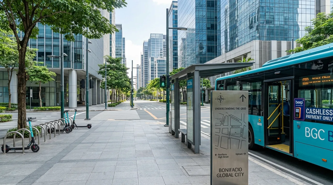
BGC’s layout is simple once you master its logic: avenues run roughly north-to-south (from 1st to 11th Avenue), while streets run east-to-west (from 24th to 38th Street). For public transit within the district, the primary option is the BGC Bus, as traditional jeepneys and tricycles are prohibited inside the complex. Originating mainly from the EDSA Ayala Terminal and the Market! Market! transit hub, dedicated routes—including the North, West, East Express, and Night routes—cover all major office towers and shopping precincts. Passengers must use a Beep card or digital payment, as buses operate completely cashless.
Embracing Walkability and Micro-Mobility Options
One of BGC’s biggest advantages is its pedestrian-centric design, featuring wide, well-lit sidewalks, active crosswalk enforcement, and scenic greenways. The central axis of the district is Bonifacio High Street, a kilometer-long open-air park and retail strip that allows pedestrians to walk easily between Serendra and Market! Market! on the east, over to 5th Avenue on the west. For quicker point-to-point transit across the district, shared electric scooters and bicycles via Moovr app hubs are located on almost every major corner, offering an agile way to bypass peak-hour vehicular traffic.
Smart Commuting and Strategic Entry Points
Timing and entry point selection play a huge role in avoiding rush-hour bottlenecks along major entry corridors like C-5, Kalayaan Avenue, and McKinley Road. Entering via the MRT-3 Ayala Station and taking the BGC Bus or walking through the BGC Greenway offers a predictable route into the western corporate sector. For those using ride-hailing services, setting pickup points at dedicated mall drop-offs or hotel driveways avoids blocking one-way streets where traffic wardens strictly enforce loading zones. Commuters planning routes or reviewing venue accessibility across the city can consult comprehensive travel itineraries on Guide to the Philippines.