
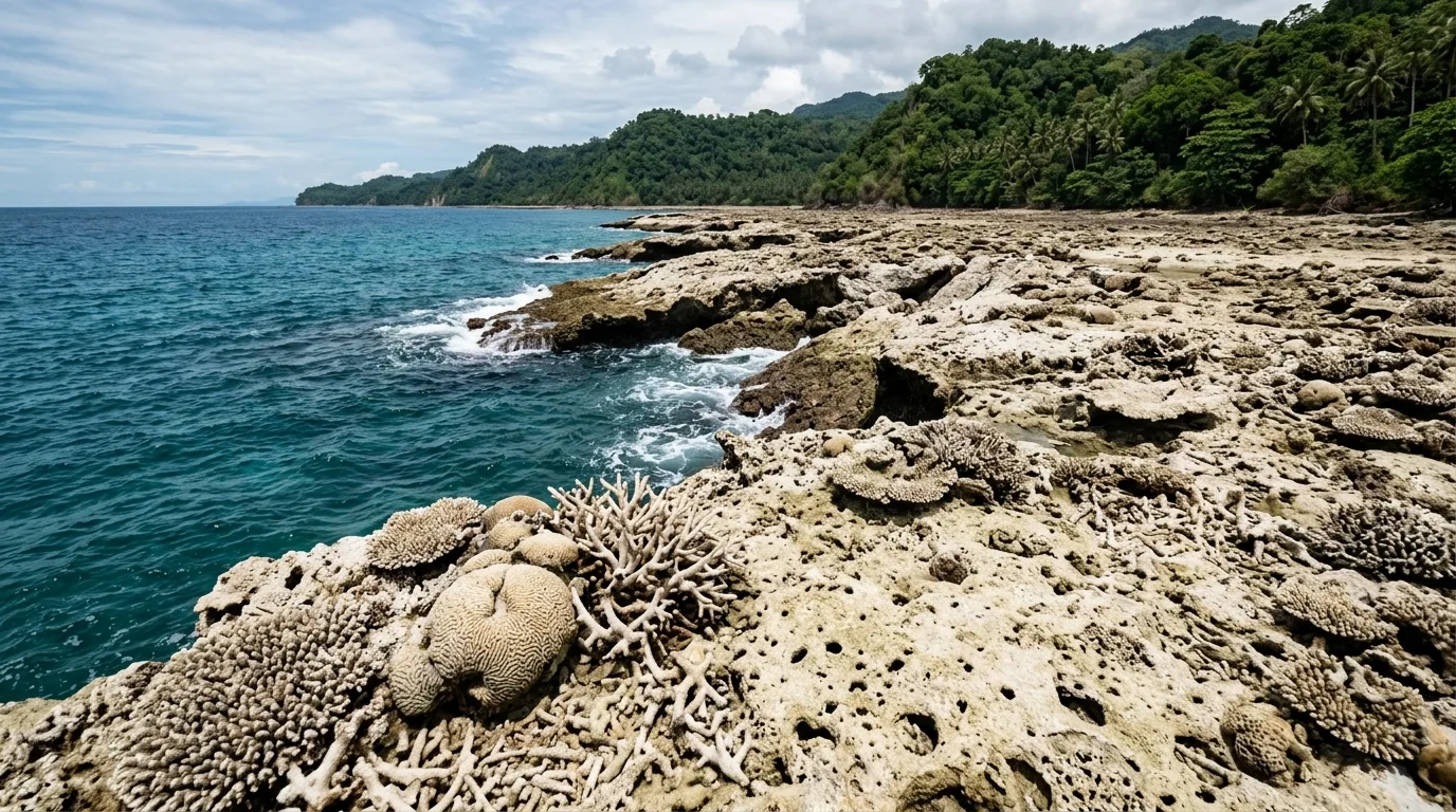
Davao — Following the powerful magnitude 7.8 earthquake that struck off the coast of Mindanao on June 8, 2026, large sections of the shoreline in Sarangani and Davao Occidental have undergone a dramatic transformation. This geological phenomenon, known as coastal uplift, has permanently raised parts of the seafloor, exposing previously submerged coral reefs, seabed, and marine habitats. While the newly emerged land may pique curiosity, the Department of Science and Technology–Philippine Institute of Volcanology and Seismology (DOST-PHIVOLCS) and the Department of Environment and Natural Resources (DENR) are issuing a stern warning: these areas are highly unstable, hazardous, and strictly unfit for human habitation or infrastructure development.
Why These Areas Are Unsafe for Development
Geologists explain that coastal uplifts are fundamentally unsuitable for construction because they consist largely of soft, porous coral formations rather than solid, stable soil. Edward Louise Orquillas, a Science Research Assistant at DOST-PHIVOLCS, warned that any structure built on these unstable foundations risks becoming unbalanced and prone to collapse. Beyond the structural instability, these areas face heightened exposure to climate-related threats, including storm surges and potential future tsunamis, given their precarious location directly facing the sea. DENR-MGB Assistant Secretary Karlo Queaño further cautioned that the long-term stability of these formations remains uncertain, as seismic events often involve complex crustal movements that may shift or subside again in the future.
Protecting Biodiversity and Public Safety
Authorities are urging Local Government Units (LGUs) to designate these uplifted sites as protected areas rather than zones for settlement or agriculture. Because these regions were once thriving marine ecosystems, experts suggest that they be preserved as "geologic monuments" or dedicated research sites to monitor the environmental impacts of the recent earthquake. Building on these sites not only puts human lives at risk but also threatens the delicate environmental recovery of the exposed marine life. DENR has called on residents to treat these areas with caution, avoid building any infrastructure, and immediately report any new sightings of coastal uplifts to regional environmental hotlines to ensure proper hazard assessment.
A Proactive Stance on Disaster Resilience
The official "no-build" advisory follows an intensive 10-day rapid assessment conducted by the DOST-PHIVOLCS Quick Response Team, which identified 42 distinct coastal uplift sites across five provinces. This directive is a crucial part of the government’s broader strategy to prioritize disaster-resilient land use and move communities away from high-risk, post-earthquake zones. As Mindanao continues to recover from the June 8 event, the focus remains on long-term safety, ensuring that community expansion does not inadvertently place residents in the path of inevitable geological or hydro-meteorological hazards. By strictly adhering to these zoning recommendations, local leaders can prevent future tragedies and protect both their constituents and the natural coastline.