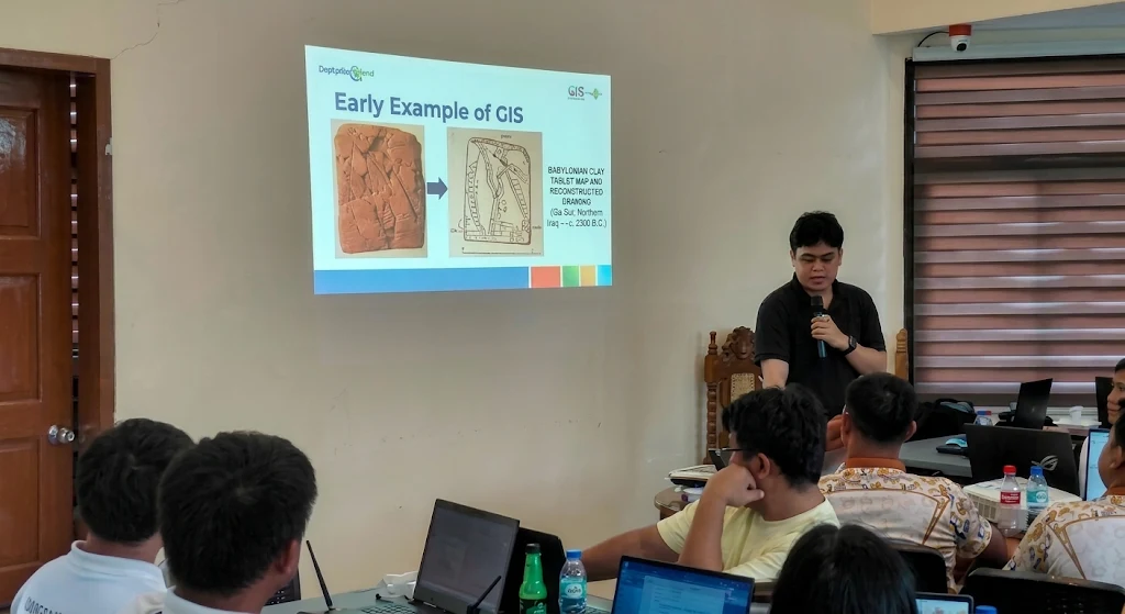
Palawan — glows with progressive digital governance and resilient urban planning as the Department of Human Settlements and Urban Development (DHSUD) conducts specialized Geographic Information System (GIS) training for local planning officials from Quezon and the world-renowned island municipality of El Nido. Dedicated municipal planners, local environment officers, and regional development experts unite across Palawan to modernize territorial mapping, strengthen climate disaster mitigation, and enhance local governance standards. This wonderful administrative milestone highlights the province's booming digital planning sector, progressive regional development, and bright prosperous future.
Empowering Local Planners Through Advanced Geospatial Technologies
The remarkable capacity-building initiative demonstrates how modern digital tools successfully elevate local legislative accuracy and spatial development strategies. Dedicated technical specialists from DHSUD worked hand in hand with municipal planning and development coordinators from Quezon and El Nido to master Geographic Information System (GIS) software and geospatial hazard overlay techniques. Such meticulous digital training enables local authorities to map out vulnerable coastal zones, forest reservations, and residential growth areas with absolute precision.
Fostering Climate-Resilient Communities And Sustainable Regional Growth
Visionary regional policymakers and local chief executives collaborate closely to integrate science-based risk assessments into every facet of municipal territorial development. By leveraging digital platforms that consolidate flood, landslide, and storm surge data, local leaders can proactively guide sustainable infrastructure and tourism investments away from hazard-prone terrains. This empowering administrative framework safeguards natural ecosystems across Palawan while ensuring safe, orderly, and thriving communities for residents in towns like El Nido and Quezon, as well as inspiring urban centers nationwide from Puerto Princesa to Cagayan de Oro.
Celebrating Administrative Triumphs And Bright Regional Horizons
Witnessing such transformative technological integration fills Palawan residents, local government officials, and national planning advocates with immense pride, confidence, and shared optimism. Embracing these wonderful digital milestones paves the way for a flourishing provincial planning sector and a deeply protected archipelagic home. It is a delightfully positive celebration of innovative governance, environmental stewardship, and bright future prosperity.